
Planetary Picture of the Day
Week of May 24, 2021
Take a glimpse at a sunset on Mars and a peek at the moon Dione “floating” above Saturn’s rings, along with a couple of Hubble and Curiosity’s greatest views!
Monday, May 24, 2021
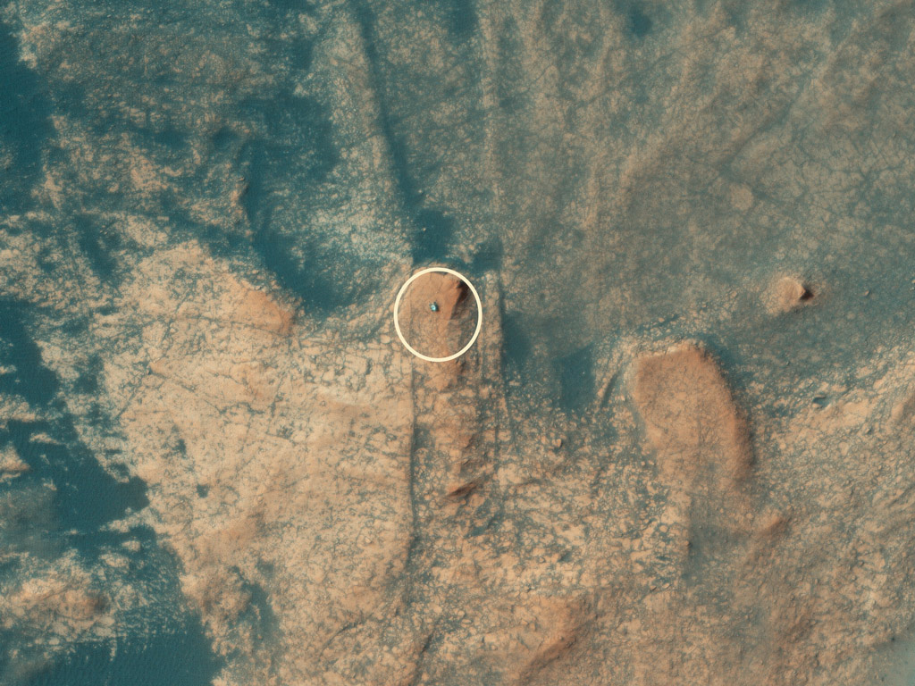
Curiosity captured from orbit!
NASA's Curiosity rover has been exploring Gale Crater since 6 August 2012 and has driven more than 25 kilometers to date. This image from the HiRISE camera on the MRO spacecraft shows the rover as it is ascending “Mount Mercou,” a broad outcrop of rocks on the northern flank of “Mount Sharp” near the center of the crater.
Gale Crater is approximately 150 kilometers across, and Mt. Sharp is more than five kilometers high in total. The rover is about the size of a small car and is currently located near and above an approximately six-meter-high cliff where it examined the exposed rocks.
The rover previously drilled into the rocks at the base of the cliff. Scientists are interested in comparing the rocks from the bottom to the top to investigate how any changes may relate to the appearance of the rocks exposed on the cliff face.
Tuesday, May 25, 2021
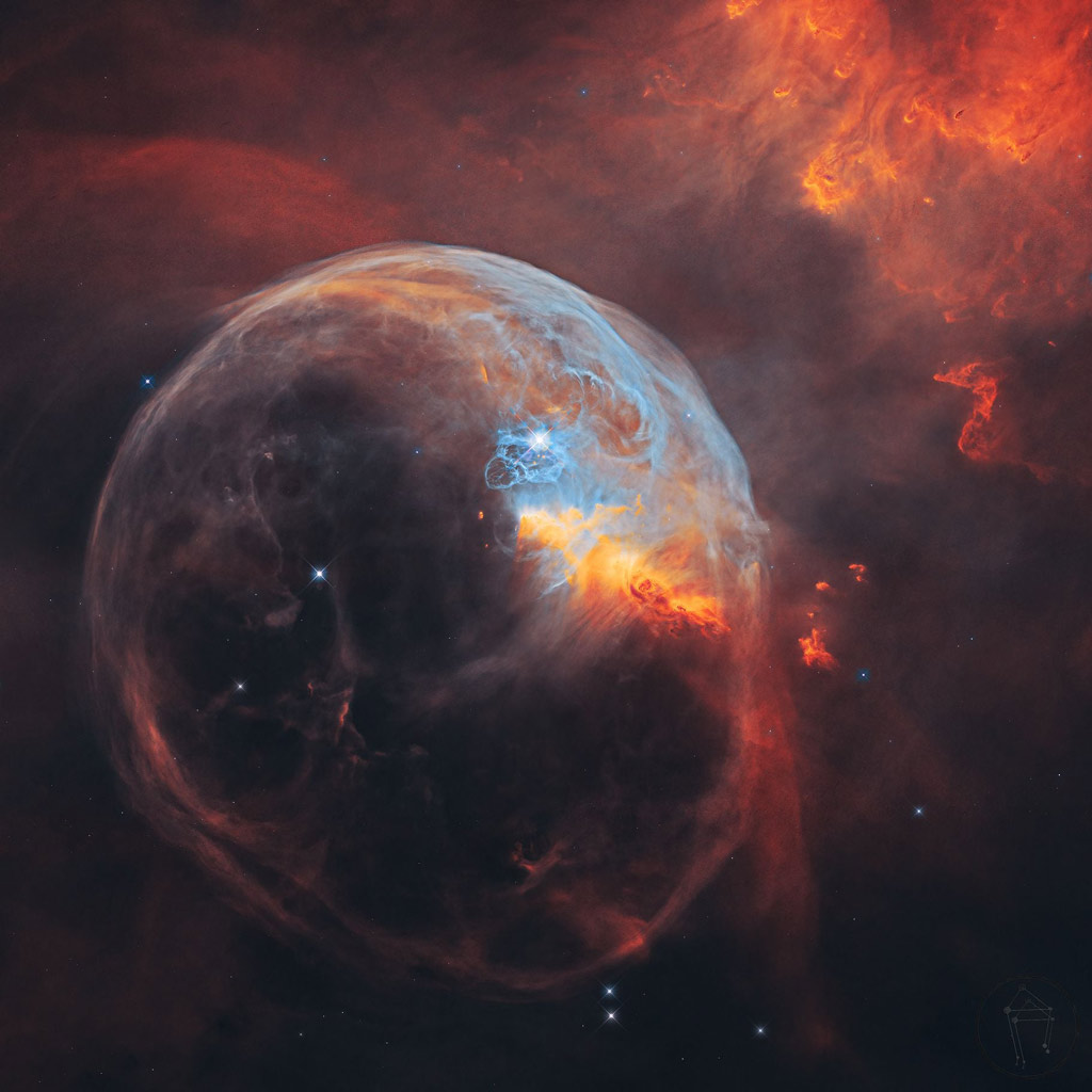
Bubble Nebula
Also known as NGC 7635, the Bubble Nebula is seven light-years across – about one-and-a-half times the distance from our sun to its nearest stellar neighbor, Alpha Centauri – and resides 7,100 light-years from Earth in the constellation Cassiopeia. One of the Hubble treasures!
Wednesday, May 26, 2021
Synthesis of all available global-scale ocean and sea ice data by NOAA
This is a truly amazing video.
To increase understanding and predictive capability for the ocean’s role in future climate change scenarios, the NASA Modeling, Analysis, and Prediction (MAP) program has created a project called Estimating the Circulation and Climate of the Ocean, Phase II (ECCO2): High-Resolution Global-Ocean and Sea-Ice Data Synthesis.
ECCO2 produces increasingly accurate syntheses of all available global-scale ocean and sea-ice data at resolutions that start to resolve ocean eddies and other narrow current systems, which transport heat, and other properties within the ocean. ECCO2 data syntheses are created by using the available satellite and in-situ data in the Massachusetts Institute of Technology General Circulation Model (MIT GCM). ECCO2 simulates ocean flows at all depths, but only surface flows are used in this visualization. The global sea surface current flows are colored by corresponding sea surface temperatures. The sea surface temperature data is also from the ECCO2 model. You can read more here: https://buff.ly/3vzBqtD.
Thursday, May 27, 2021
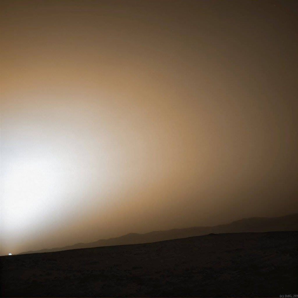
Sunset at Gale Crater
Martian sunset vista at Gale crater rim snapped by Curiosity on Sol 312, June 22, 2013. Colorized Navcam image.
Friday, May 28, 2021
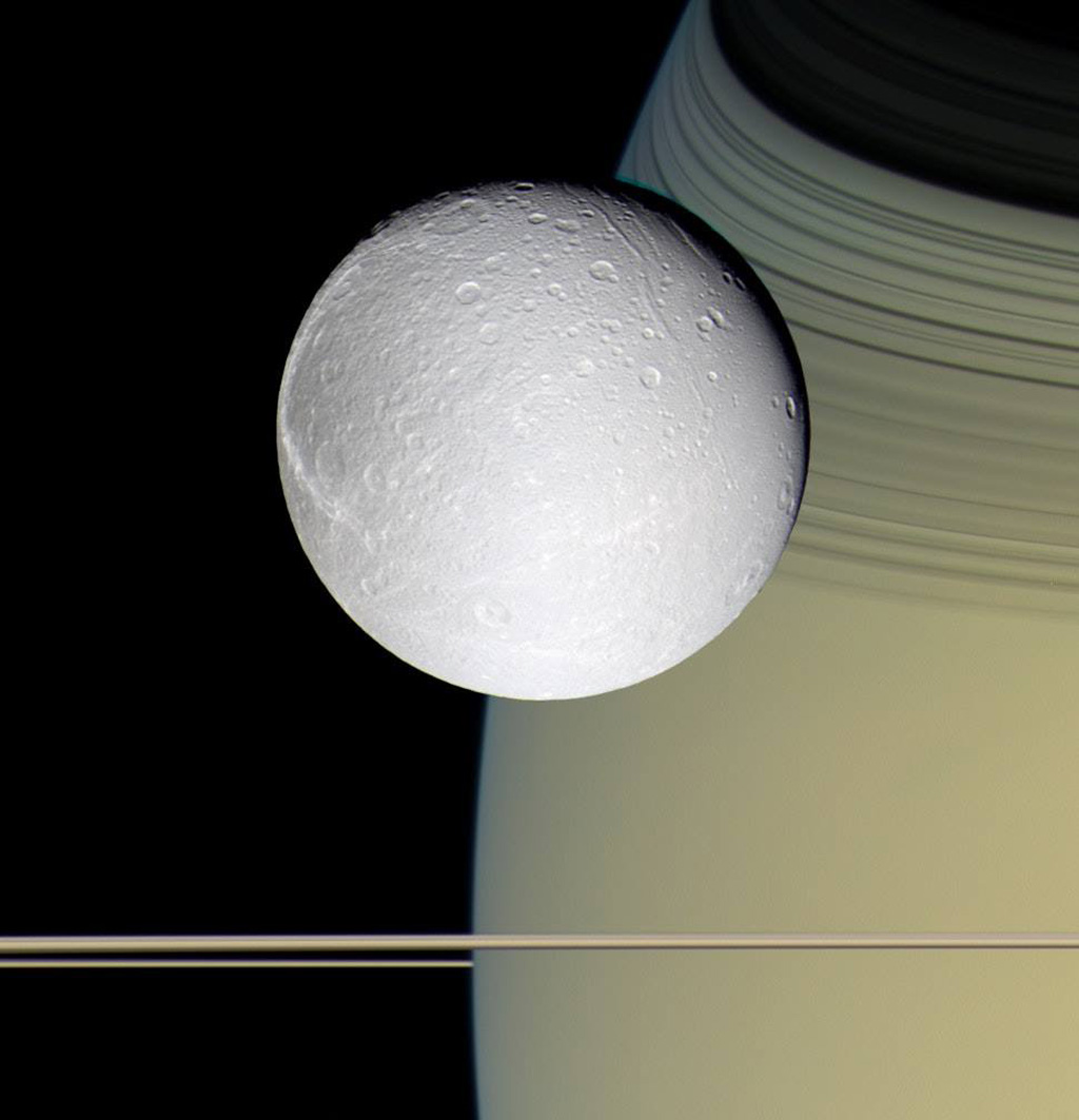
Dione seen with Saturn’s rings
Seen approximately as it would be to the human eye, this image of Saturn's moon Dione was taken on 11 October 2005 by the NASA/ESA/ASI Cassini spacecraft. Blue, green and infrared (centred at 752 nanometres) spectral filters were used to create this colour view. The images were obtained with the Cassini spacecraft wide-angle camera at a distance of approximately 39 000 kilometres from Dione. The image scale is about 2 kilometres per pixel.


