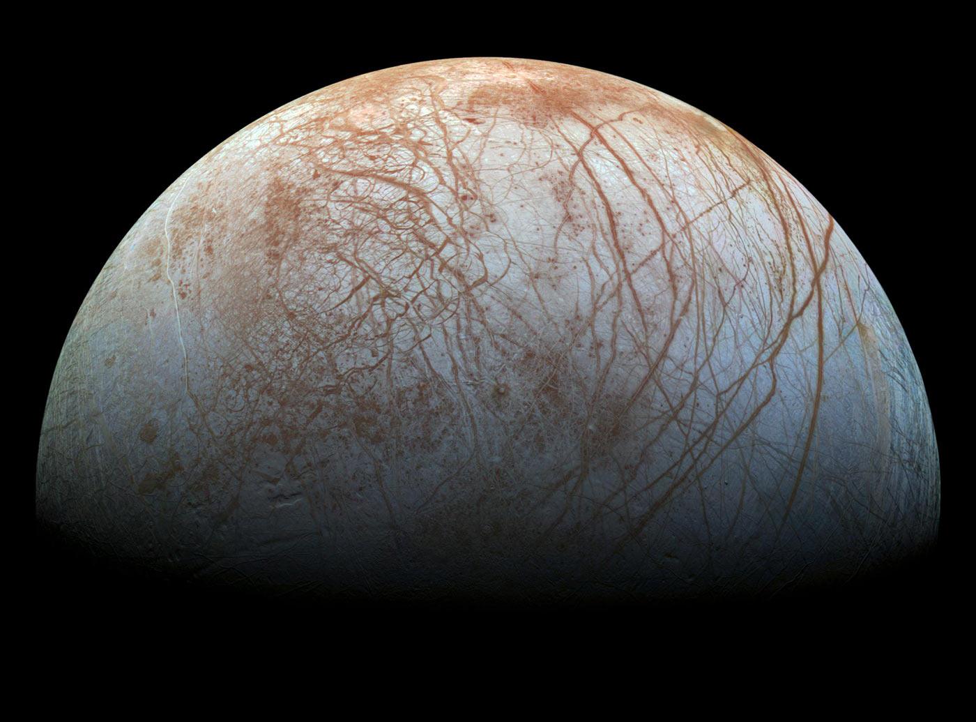
In March and September of 1998, the Galileo spacecraft that studied Jupiter and its moons, captured images of Europa in a flyby. Now, in 2020, a new look at the photos, in preparation for NASA’s Europa Clipper probe, has yielded some stunning and detailed results.
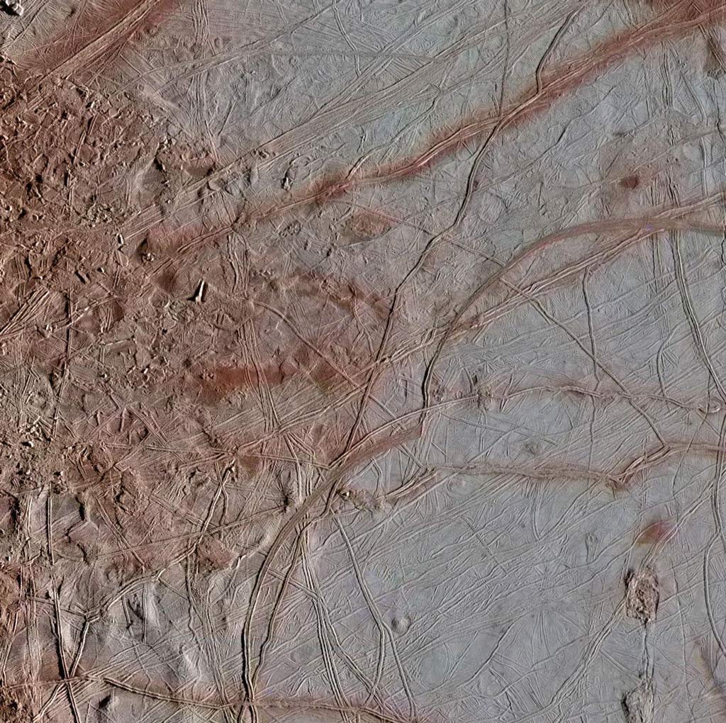
SETI Institute engineer Mario Valenti applied high tech image processing techniques to three observations captured along the same longitude of Europa. They were pieced together from 36 images covering a vertical strip that goes from the far northern latitudes to the far southern latitude of the moon. The average resolution of these images is 224 meters per pixel. Since the spacecraft provides its best estimate of each image's location, a lot of work is required to get each image precisely aligned.
Each image was taken using the clear filter, which results in a greyscale image. The image was colorized by aligning it with a lower resolution reprocessed global image of Europa (https://photojournal.jpl.nasa.gov/catalog/PIA19048). This image uses near-infrared, green, and violet rather than red, green, and blue to exaggerate the color variations to better show differences in chemical composition. Bluer areas show water ice, while redder areas show other minerals and salts. These images are part of an ongoing project to reprocessed Galileo Europa images leading up to the upcoming Europa Clipper mission.
Each section was taken to show the variations in the terrain across the surface of Europa.

https://photojournal.jpl.nasa.gov/catalog/PIA23873.

The Europa Clipper mission will study Europa through a series of flybys and is scheduled to launch in 2024.